
Lathrop Lake State Park
Blog 402: A Gorgeous Gorge and a Cripple Creek
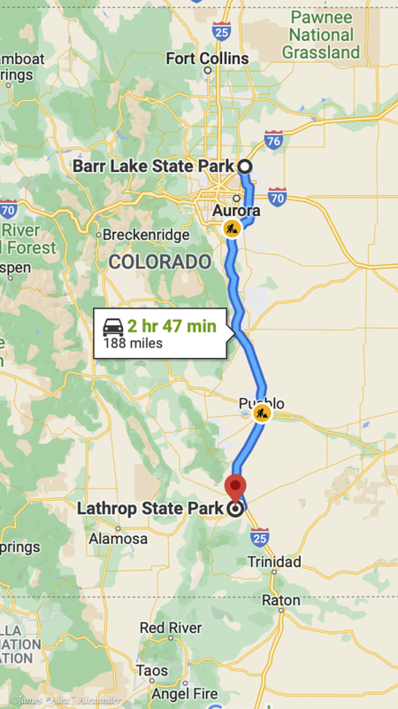
We drove 195 miles pretty much south on Interstate 25, and then pulled into a great campsite at Lathrop Lake State Park—a very nice campground in a very nice park, complete with lakes, trails, and a golf course.
Scenic Highway of Legends
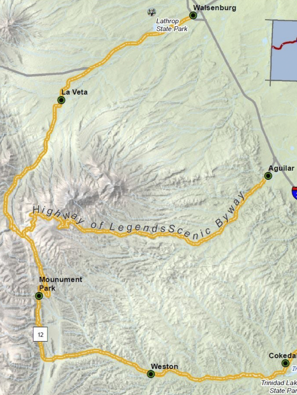
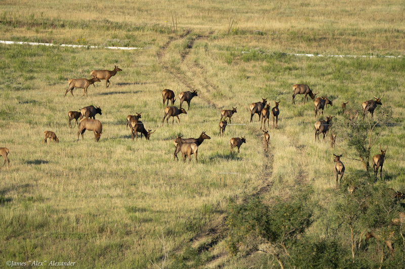
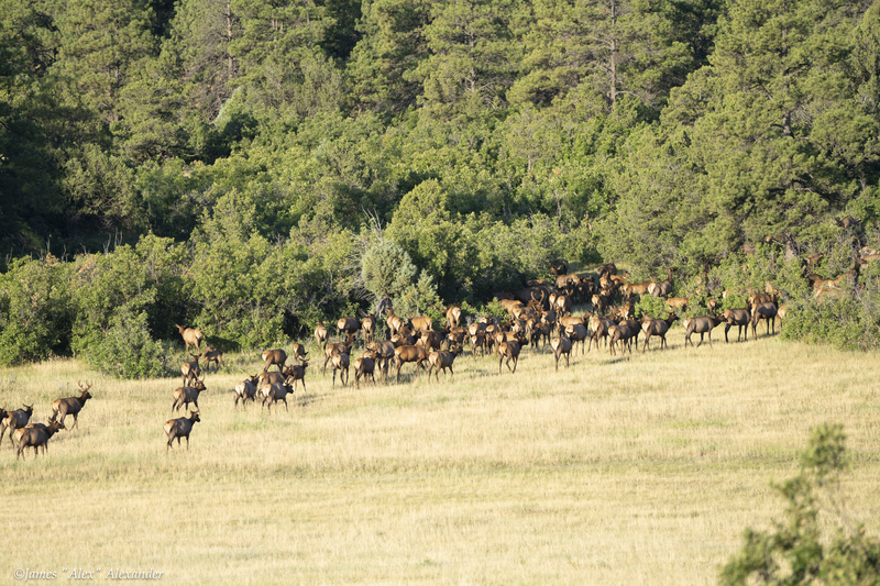
The first day, we took one component of the Highway of Legends. We departed at 6:45 a.m. and headed south to Aguillar, and then west toward Highway 12. Sunrise was at 6:15 a.m., and at 7:00 a.m. we were rewarded with a great view of more than 300 elk, all heading north. Quite impressive.
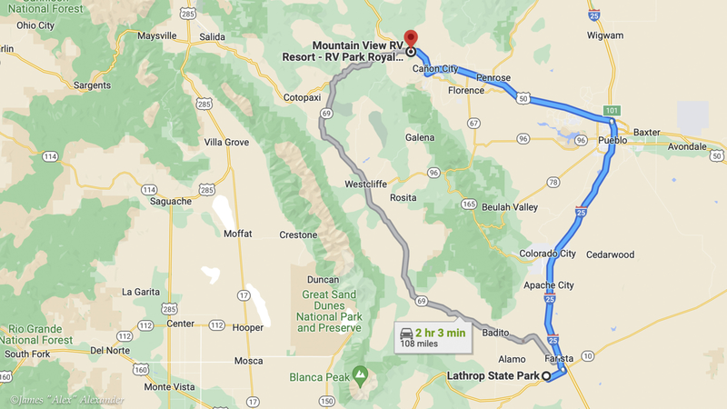
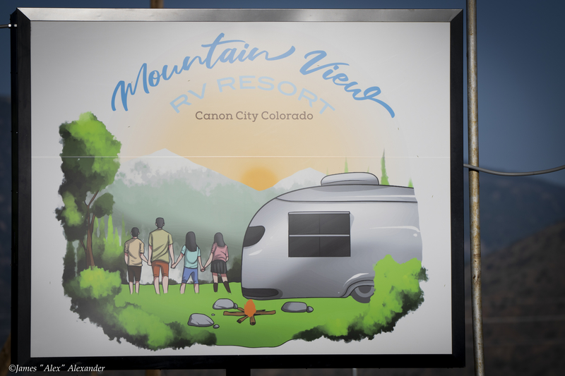
From Lathrop State Park we drove the 108 miles to Mountain View RV Resort, just three miles from Royal Gorge and all the local action.
Royal Gorge
We stayed at a very nice RV park that was close to all the local Canon City action. A few years back, we had visited the Royal Gorge area with our good friends Suzanne, Kathie, and Gary. It was nice to return to this very scenic area.
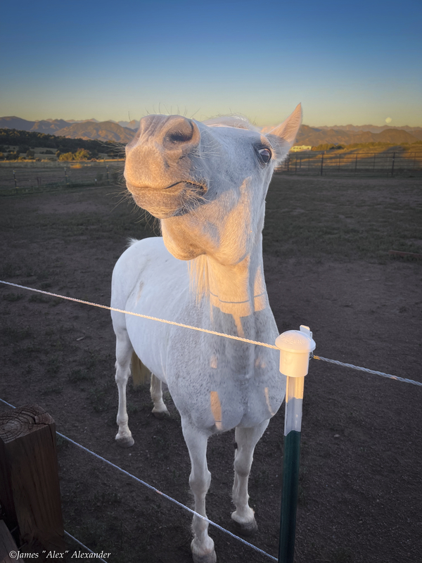
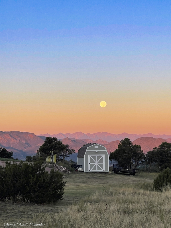
They call the Royal Gorge region the banana belt of Colorado because it is typically 10 degrees warmer than Denver or Colorado Springs. So almost every day of our two-week stay it crept up to the high 80s/low 90s. But with low humidity, nice shade, and a sweet breeze, it was very comfortable sitting out each afternoon. Here is a horse with attitude and a sunrise shot taken from my morning walks.
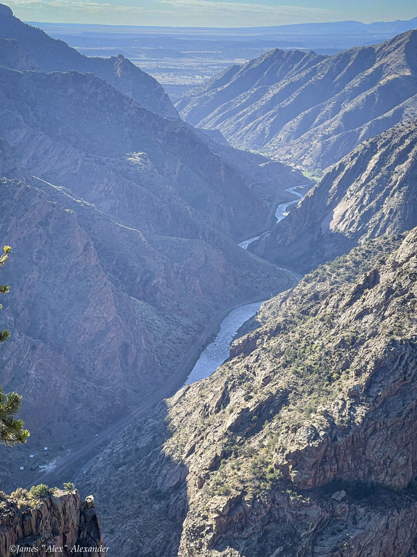
Very nice stay. We would come back. Here is a pic of the Royal Gorge we took on a hike.
Cripple Creek
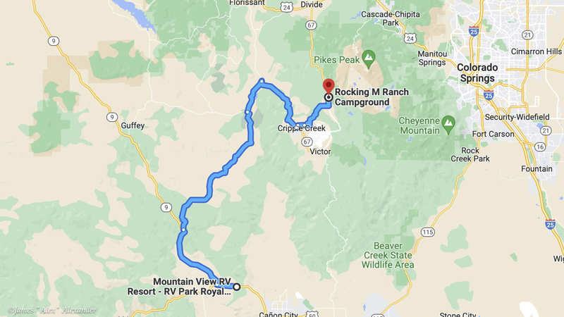
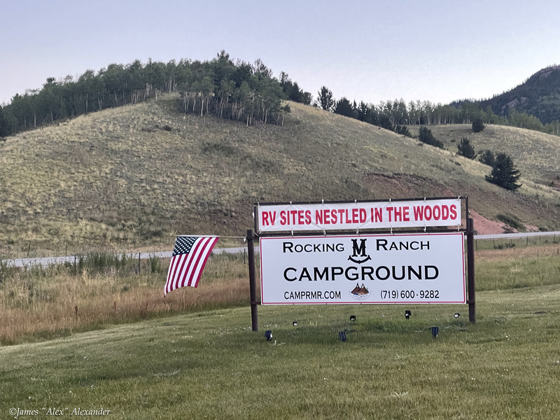
From our Mountain View campground near the Royal Gorge, we took curvy highways and well-kept country roads for 48 miles up from 5,000 to 10,000 feet to our campground just a few miles north of Cripple Creek. The Rocking M Ranch campground is small, around 35 sites total, and new (just their second season). Very nice owners and the camp hosts were capable, friendly, and fun to hang with.
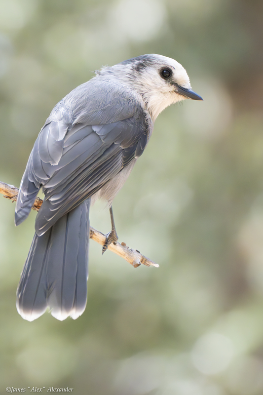
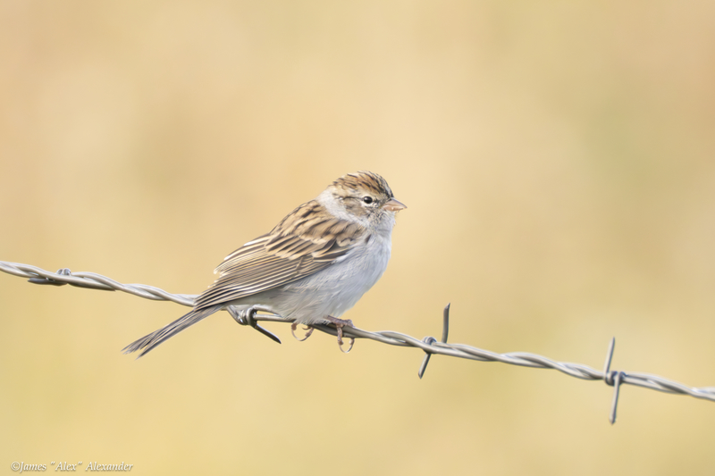
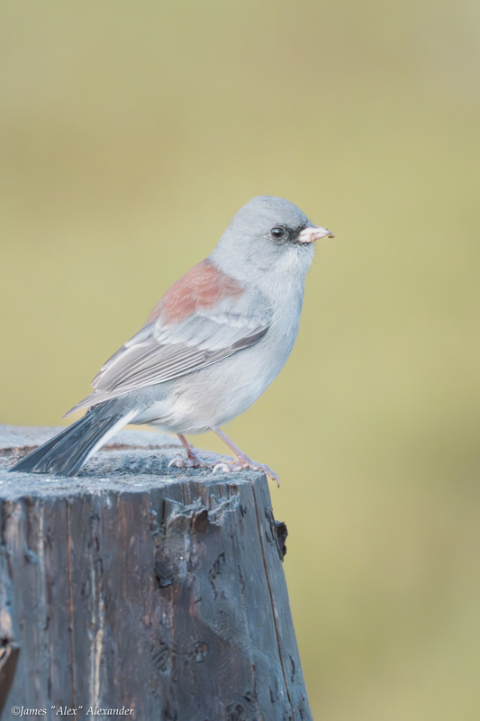
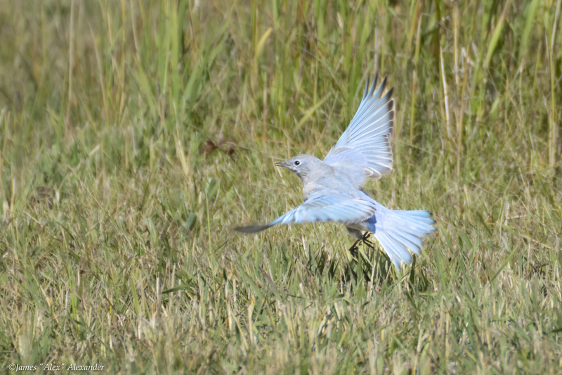
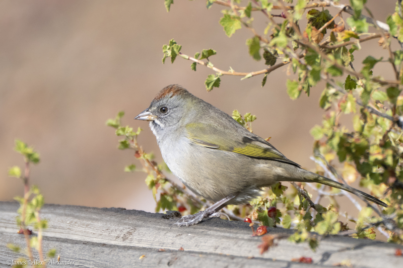
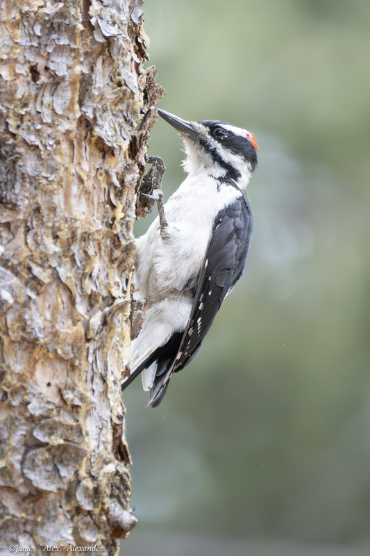
Most days we would sit outside our motorhome enjoying a campfire (when the burn ban was not in place). Here are a few bird pics shot from our campground site or nearby within the park: Canada jay, chipping sparrow, dark-eyed junco, flying male mountain bluebird, green-tailed towee, and a hairy woodpecker.
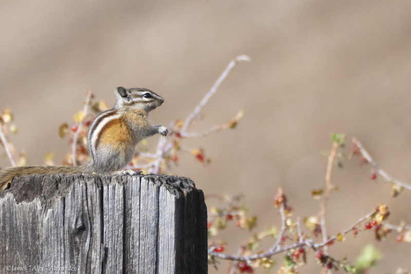
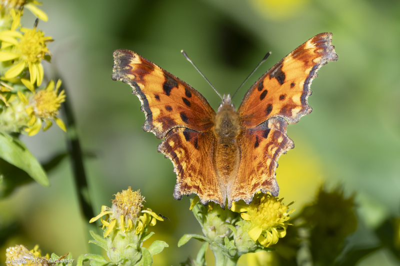
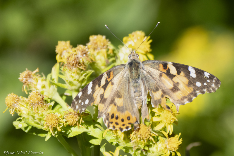
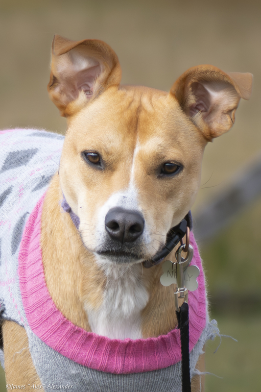
Also in the campground, to the Pups delight, there were Western chipmunks as well as question mark butterflies and painted lady butterflies. Our campground hosts had a great dog named Nelly.
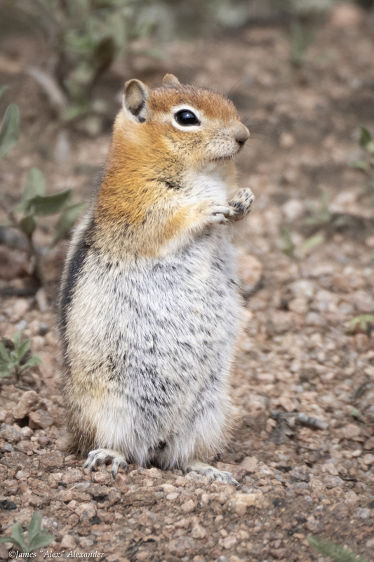
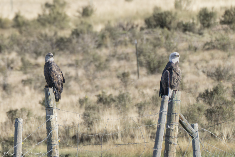
Nearby, we spotted this good-looking mountain striped ground squirrel, and within a mile, a pair of bald eagles. Often, we would spot big horn sheep off the highway, sometimes within 10 feet or so of our passing car.
Cripple Creek
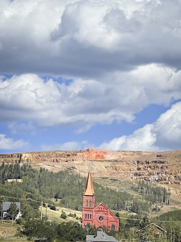
Gold mining was and still is the biggest industry in Teller County. A huge, active mine is nearby displaying the really big equipment at work. The area is best known now for gambling, with lots of hotel/casinos. There had been lots of nice stores and cool shops, but COVID took its toll, and many storefronts were vacant. There are lots of trails and many scenic drives in the county. Here is a shot of a red church from a distance.
Mueller State Park
About 15 minutes north of our campground is the beautiful Mueller State Park. Gorgeous setting with lots of nice trails. The only drawback is that our coach is too big for the campground and none of the trails allow dogs. We took a two-mile, volunteer-led nature hike one day, and came back another day to walk in the “pups allowed” campground.
Shelf Road/Gold Belt Tour
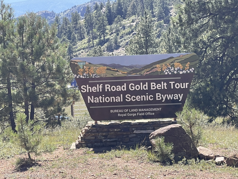
We took several day trips while in the area, with our biggest being the Shelf Road section of the Gold Belt Tour Scenic Byway.
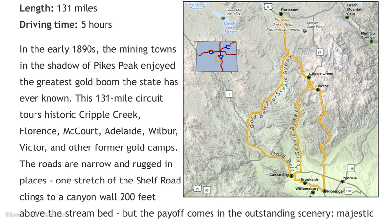
We started our 27-mile journey in Cripple Creek on a dirt road heading south. Rough in many places, the road dictated slow driving—perfect for enjoying the scenery. The “shelf” refers to a five-mile stretch that hugs the sheer rock walls above the Fourmile Creek. Unfortunately, over the years, a vehicle or two has taken the plunge. At the end of the dirt road, we picked up highway 50 where we drove to Canon City, and then took paved back roads up and around back to our campground, just a little north and east of Cripple Creek. Taking our time, the trip took five-and-a-half hours—well worth it.
Finally, here is a shot of Pike’s Peak from the west side.

Note: This blog only covers part of our wonderful stay at the Rocking M Campground. My next blog will cover our experience at or near Victor, just seven miles from Cripple Creek.